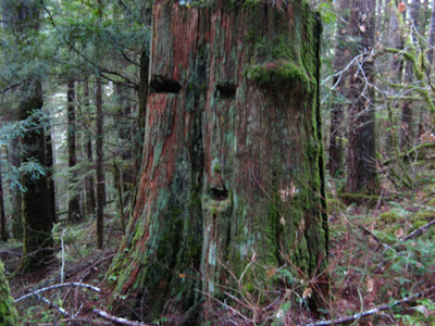
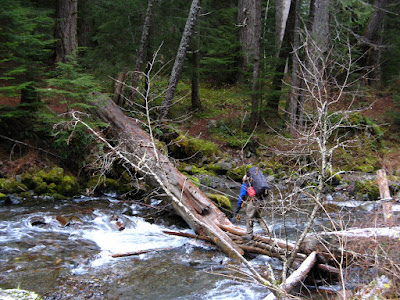
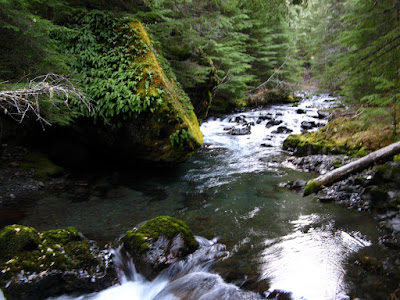
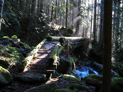
Yeah 4 day weekends! I spent Thanksgiving Day and Black Friday in the Necklace Valley in the Cascades. The first few miles of the hike in reminded me a lot of the Olympics...very green and lush old growth forest and a smooth well-traveled trail.
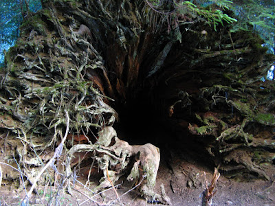
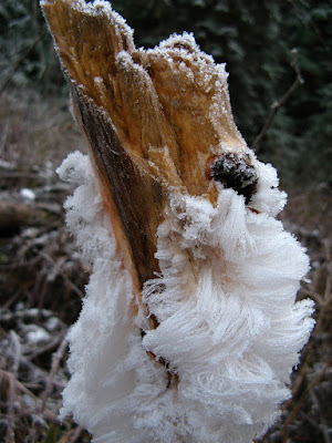
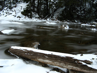
Something was definitely living in this downed tree. I couldn't see very far in, and I wasn't about to stick my head in. Soon after this, I headed up a very narrow gorge that lead to the Necklace Valley. I gained elevation very quickly and the temperature dropped while the snowpack climbed. I saw lots of these around.
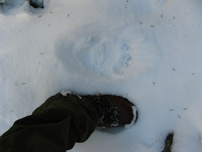
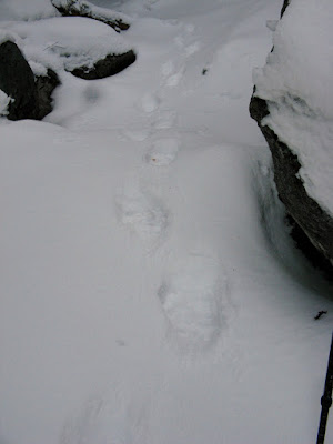
...so I sang some songs about how I love bears nice and loud so that they would hear me coming and noone would surprise anyone else. After about 5 hours of hiking, I reached the first of the lakes in the valley.
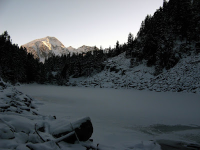
I knew there was a shelter somewhere on the west side of one of the lakes, but the scope of my map was way too large and it was hard to make out fine detail. After looking for it for about an hour, I finally just found a nice level area near the confluence of 2 streams and set up bivy camp at sunset. Being in a north facing valley, sunset comes early and sunrise late.
Task A#1 was hanging the best bear bag setup of my life before it got any darker. I've been somewhat lax in the past about bear-bag setups and cooking, but that was when I was more worried about mini-bears (chipmunks) getting into my food than ursa major sniffing around at night. I cooked Thanksgiving dinner (Annies with tuna and dried cranberries..mmmm) nice and far from camp too. By the time I was done eating it was pitch dark...but not for long.
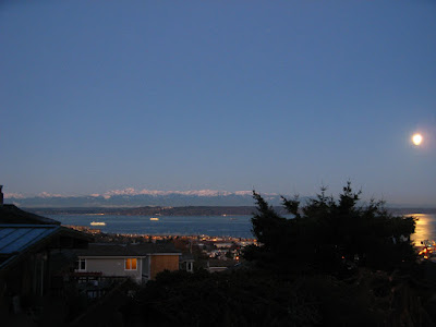
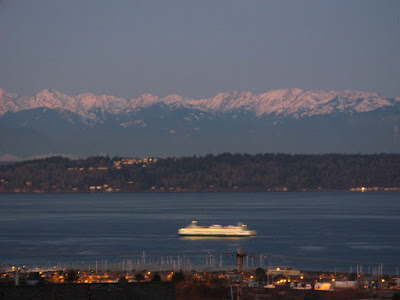
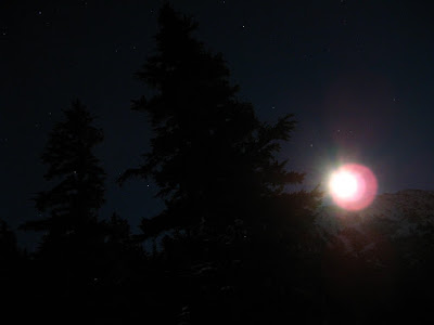
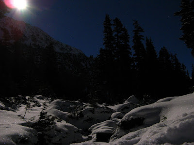
I had forgotten about the full moon. Around 7pm the moon rose over the east ridge of the valley. It was light enough to easily walk around without a headlamp. The following pictures were all taken without flash at long exposure.
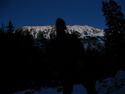
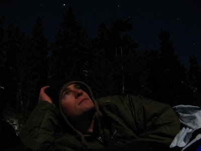
I spent the next few hours taking photos and reading, and by 10pm I finally went to sleep. Only 9 hours til dawn. It was a cold night and at dawn I did not want to get up...it was about 0 F. Not expecting temps this low, I didn't have down booties with me...big mistake. When I finally did get up, I dropped the bear bag, downed a cup of tea, packed my day bag and started hiking as fast as I could. Nevertheless, my feet were frozen by the time I started moving. They didn't fully thaw for another hour or so.
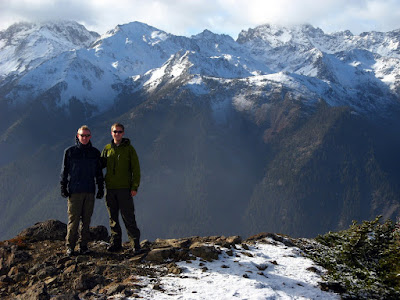
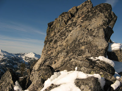
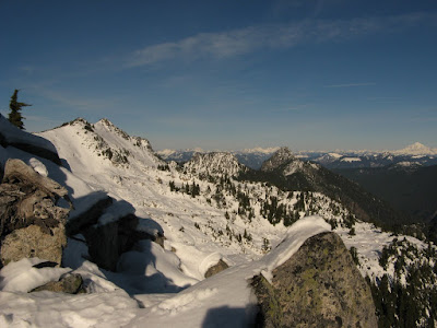
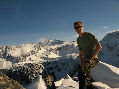
I hiked to the head of the valley and out onto a shallow but very frozen swamp so that I could see around. Everything around looked steep and very daunting. I had crampons, but no snowshoes, so postholing was a problem in the deep snow areas. I made for a gap in the mountains to the southwest and figure I could work my way up the west ridge from there. Almost as soon as I left the valley floor the sun broke over the south ridge of the valley and I was immersed in bright sunlight. I reached the La Bohm gap and continued up the western ridge of the valley, hoping to reach one of the rocky outcroppings above where I had camped. The top of the ridge was much steeper and exposed than it looked from below, so I didn't get very far before I ran into a barrier. The barrier could have been overcome with some 5.easy climbing, but a fall would have been very bad and I was alone...so I had lunch, snapped some photos and headed back down the ridge.
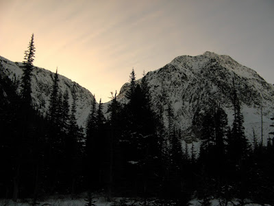
Sunrise..kinda
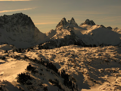
La Bohm gap, with Chimney Rock Mountain? in the distance
frustrating
looking north
I traversed through a large talus-filled bowl under the ridge and back to camp. I broke camp and started down the valley at about 12:30. I soon found the shelter I was looking for the night before. I was originally planning on spending another night out, but the cold and lonesome made me pack it in. I must be getting soft.